
Augmented Reality - My Way - Sat Images
Take a look at the video:
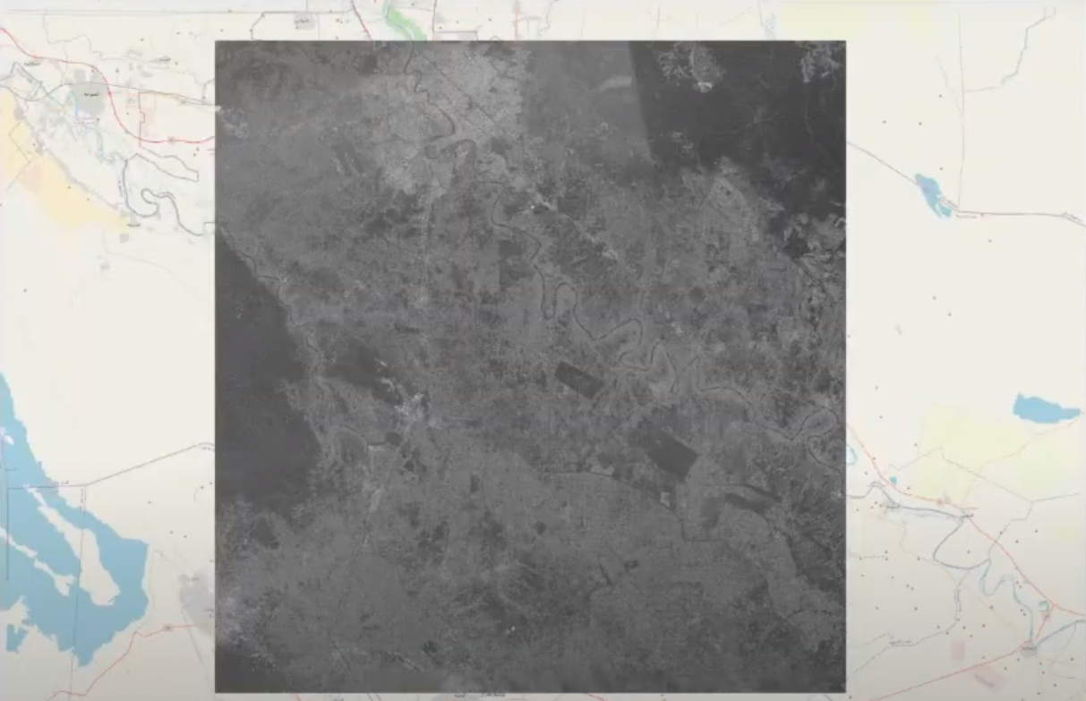
Detecting details of Baghdad from this extremely low resolution satellite picture!
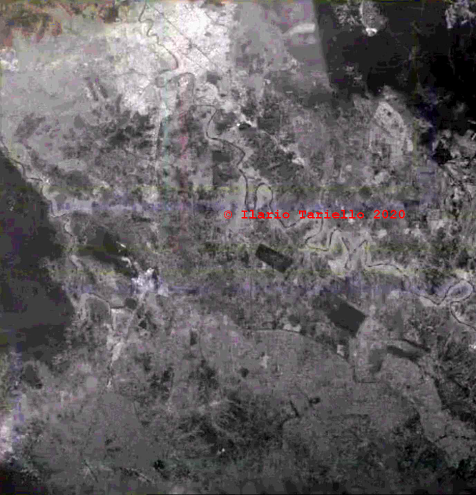
This is how it looks like after enhancing it a little bit:
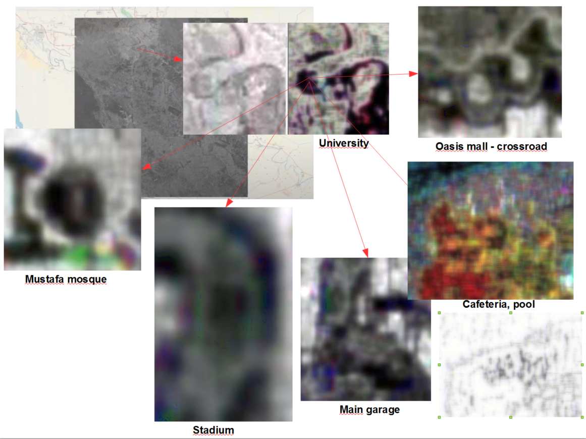
Subsequently applying other algorythms of mine, I am able to locate and recognize specific buildings in the University area of the city:
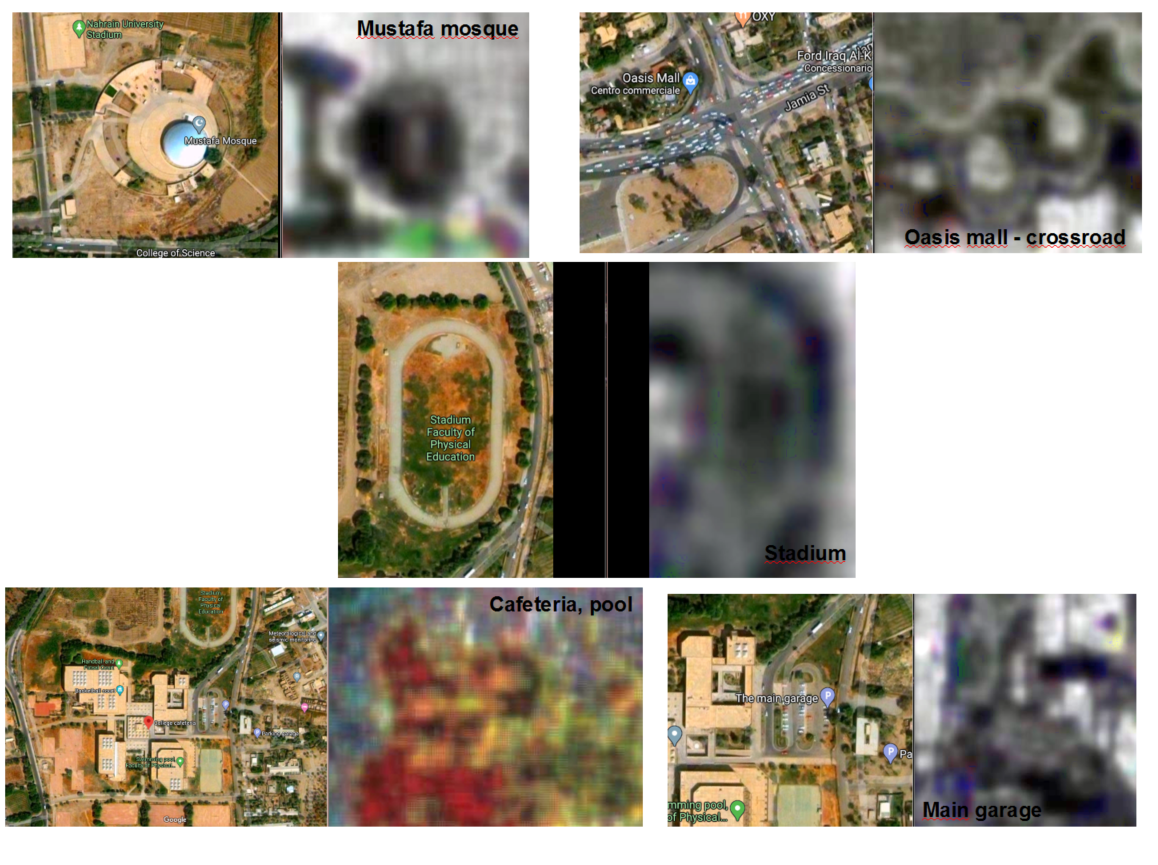
If you still have doubts, please take a look at this comparison of the 5 buildings with their images found on Google Maps:
